One of the most beautiful places to see Switzerland’s golden larches in autumn is Lac Bleu Arolla in the Central Valais region. Its intense turquoise water contrasts perfectly with the golden trees and snow-tipped peaks.
It’s just a short 40 min hike to the lake from the from the parking and bus stop. But we suggest a longer tour to enjoy more of the valley and forests before arriving at the lake.
Plan carefully, particularly for weekends, as parking fills up quickly and the bus only runs a couple few times per day.
Keep reading for directions, trail details, and how to make the most of our visit to Lac Bleu Arolla, particularly in fall.all the info you need to visit this lake.
Contents
Quick info
| Region | Val d’Herren, Central Valais, southwest Switzerland |
| Address: | La Gouille, Arolla |
| By car: | Free parking at La Gouille From Sion 50 mins, Bern 2h30, Zürich or Luzern 3h30 |
| By public transport: | Bus stop: Arolla, La Guoille (or Arolla, poste for the longer trails) From Sion 1h20, Bern 3h, Zürich or Luzern 4h |
| Trail: | 1h30 • ⬇️trail map |
| Distance: | 2.7 km round trip (longer options below) |
| Difficulty: | moderate • 263m up & down |
| Condition: | dirt footpath, uneven terrain |
| Highest point: | 2090 m |
| Open: | late June to late October |
| Cost: | free or bus fare for one way trail |
| Services: | hut café near lake, restaurants at both ends of hike |
| More info: | • weather • instagram |
Gallery


Trail Overview
Lac Bleu is a 40 min hike up from La Gouille, which has parking and a bus stop.

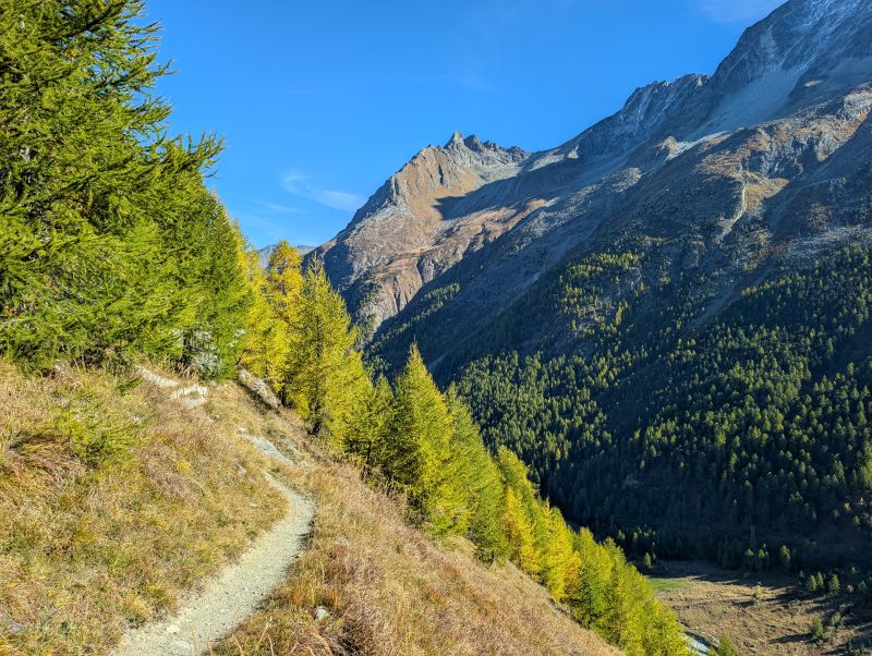
If you prefer a longer hike, you can start in Arolla and traverse the mountain to the lake (trail B). This trail is not very difficult but it does have several sections with a narrow path and steep slopes to the side, sometimes with a chain handrail. If you get vertigo, probably not a good fit for you.
For a difficult challenge, you could hike up to the Cabane des Aiguilles Rouges hut at 2800m, then down to the lake. I haven’t done this trail myself but a couple friends have and they warmly recommend it.
If you are visiting in October, it is very important to check the trail status, particularly for snow at the higher elevations.
Trail A: Direct from La Gouille
The trail map below shows the trail from La Gouille directly to Lac Bleu. You can hike up and back on the same trail.
See trail map on Komoot • SwitzerlandMobility
Trail B: One way Arolla – lake – La Gouille
This one trail allows you to enjoy the scenery a bit longer before arriving at the lake. In this case, you would need to take the bus to Arolla, poste to start the trail. The hike passes by Lac Bleu, then ends in La Gouille,
See trail map on Komoot • SwitzerlandMobility
Trail C: Hut Hike
For fit hikers, a popular option is to first hike up to the Cabane des Aiguilles Rouge hut, then down to the lake. This tour is 11.3 km, 1025m up, 855m down. See trail map.
The trail goes up to 2821m, so it often has snow in October and the trail is only possible with snow trekking gear. Check conditions carefully before heading out.
There are many trails in this area, so lots of other options to extend your tour.
How to get there
Lac Bleu is in the Evolene Val d’Herens region in southwest Switzerland.
By car
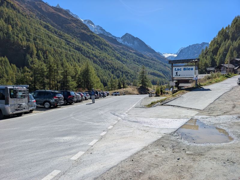
From Sion, it takes about 50 mins to drive up the winding mountain road to La Gouille. After passing through Les Houderes, the road narrows and gets even more winding. I suggest checking the PostAuto bus schedule to make sure you do not have to pass the bus as you drive up this road.
At La Gouille, there is parking on the side of the road, but not very many spots. On weekends, I would expect this to be full by 9:00 or even earlier. You may consider parking in Evolene or Les Houderes and catching the bus the rest of the way.
If you doing the hike from Arolla, you can catch the bus at La Gouille and ride to Arolla, poste to start the hike. The travel time is 13 mins. The bus only comes a few times a day, so check the schedule carefully and plan accordingly.
In October, we caught the 9:50 bus (which was 15 mins late), which was good timing to start the hike just when the sun came over the peak to light up the trail.
By public transport
The nearest train station is Sion. From there, ride bus 381 to Arolla, la Gouille or Arolla, poste depending on where you are starting your hike. Travel time is 1h20 to Arolla, poste.
The bus only comes a few times a day, so check the schedule carefully and plan accordingly.
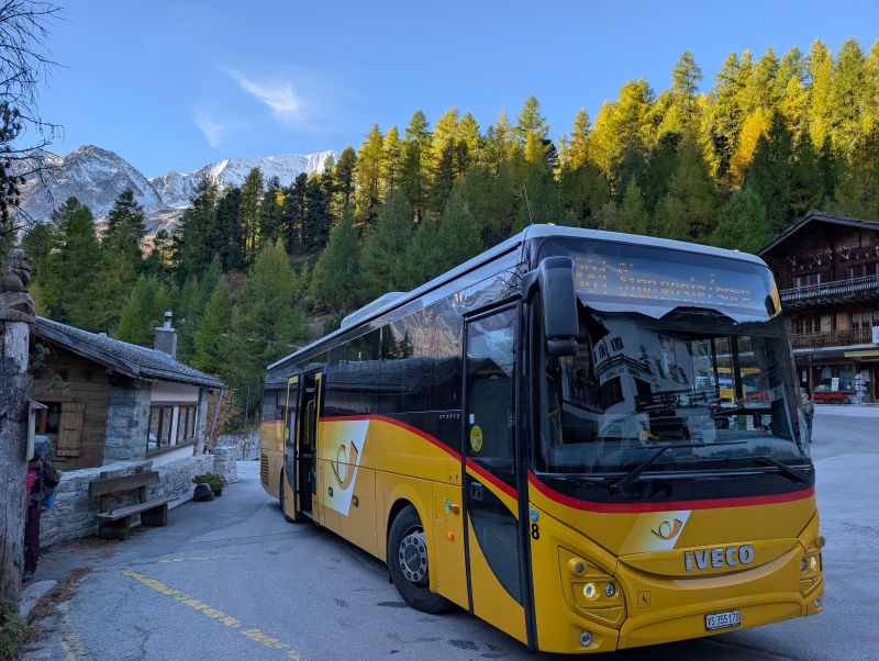
The bus is part of the SBB public transport system. Best to buy tickets on the SBB Mobile App, not on the bus. It is free with the Swiss Travel Pass and GA.
Planning your day
When to go
The direct trail to the lake is usually possible June to early November. Snow may close the trail anytime from mid September until the end of the season.
If you want the fall colors and golden larches, best to visit in mid October. Our pics here are from 9 Oct 2025.
The trail to Cabane des Aiguilles Rouges is usually snow free from early July thru September. But at that high elevation, snow can linger until later in July and arrive as early as September. Check trail conditions before heading up.
Where to eat
There is a hut just below the lake with a cafe, Buvette chez Leon. They are usually open June through early November. Closed on Tuesdays.
There are restaurants and La Gouille and Arolla, which are open during summer season. But in October, all of these were closed, so make sure to bring a picnic.
In Arolla, next to the bus stop, there is a small convenience store if you need picnic supplies. We got cheese from the local alp and fresh bread. But the selection is limited. So better to buy your picnic food beforehand.
Photo Story
I will add photos asap. I’m currently traveling.
Trail starting in Arolla.
Trail traversing the mountain.